Shared coordinates
Every accepted point, cell and boundary belongs to the same world-scale coordinate space.
Spatial systems & world architecture
Koraaver Atlas preserves the intent of an authored world while turning its geography into structured data, exact shared coordinates, validated derivatives and deliberately governed authority.
What the Atlas actually is
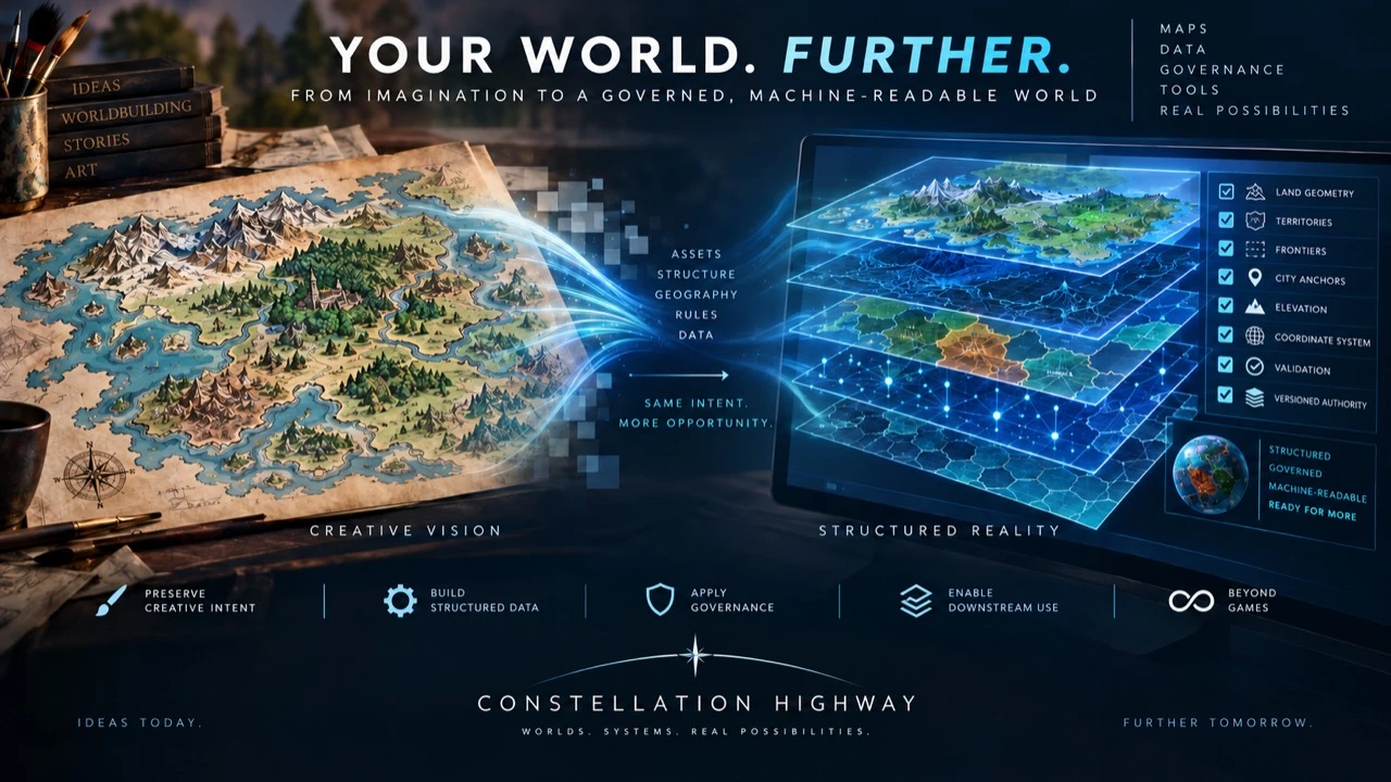
We placed the original illustrated map of Koraaver onto a fixed Cartesian coordinate system and kilometre scale. The planet has a defined extent, and its landmasses have been converted from marks on an image into geometry that can be measured and divided into canonical cells.
Those cells can be assigned to continents, countries and territories. National frontiers and coastlines become exact shared boundaries; known cities and named locations receive fixed coordinates; and an elevation model gives mapped points a height.
Physical geography is then encoded on top of that base as real spatial objects. A river, for example, becomes a defined course through particular coordinates and elevations—not simply a blue line drawn over the artwork. Mountain ranges, lakes, seas, forests and other features can be treated in the same governed way.
The source geometry, coordinates, scale and relationships are preserved in machine-readable files. Country and regional views are derived from the same global authority rather than redrawn as separate maps that can quietly disagree.
Automated checks confirm that expected cells occur exactly once, territories partition correctly, both sides of a shared frontier agree, named locations survive each transformation, and every derived representation reproduces its accepted source without silently changing the world.
One world, one coordinate system
The canonical planar space is 24,000 kilometres wide and 16,000 kilometres high. One unit represents one kilometre; the world wraps horizontally and remains bounded at its northern and southern edges.
Every accepted point, cell and boundary belongs to the same world-scale coordinate space.
Components, ownership and required neighbour relationships are resolved before borders are polished.
Country maps, continental maps and machine-readable exports inherit from common sources.
Geometry, cells, frontiers, metadata and numerical fields are retained as data—not trapped inside imagery.
A completed continental implementation
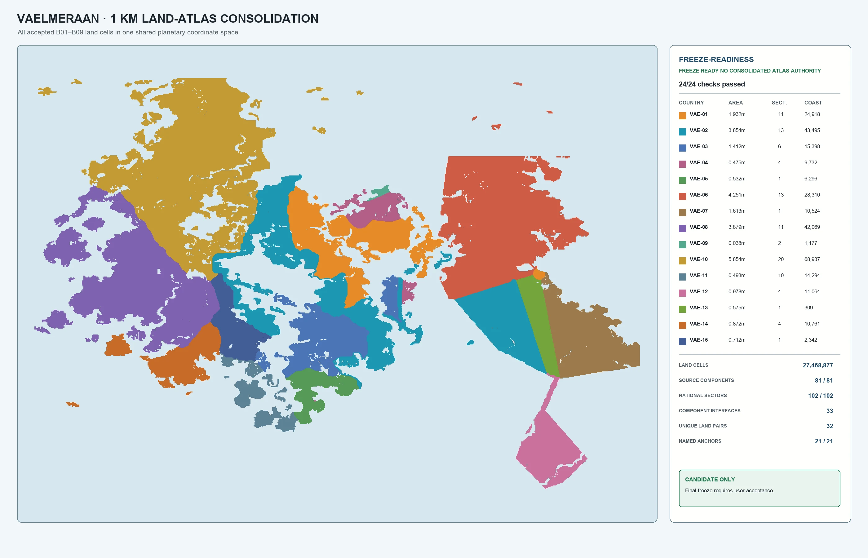
Fifteen independently operable countries now share one accepted land atlas. Exact ownership is preserved across islands, multipart territories and every accepted land frontier.
Exact country derivatives
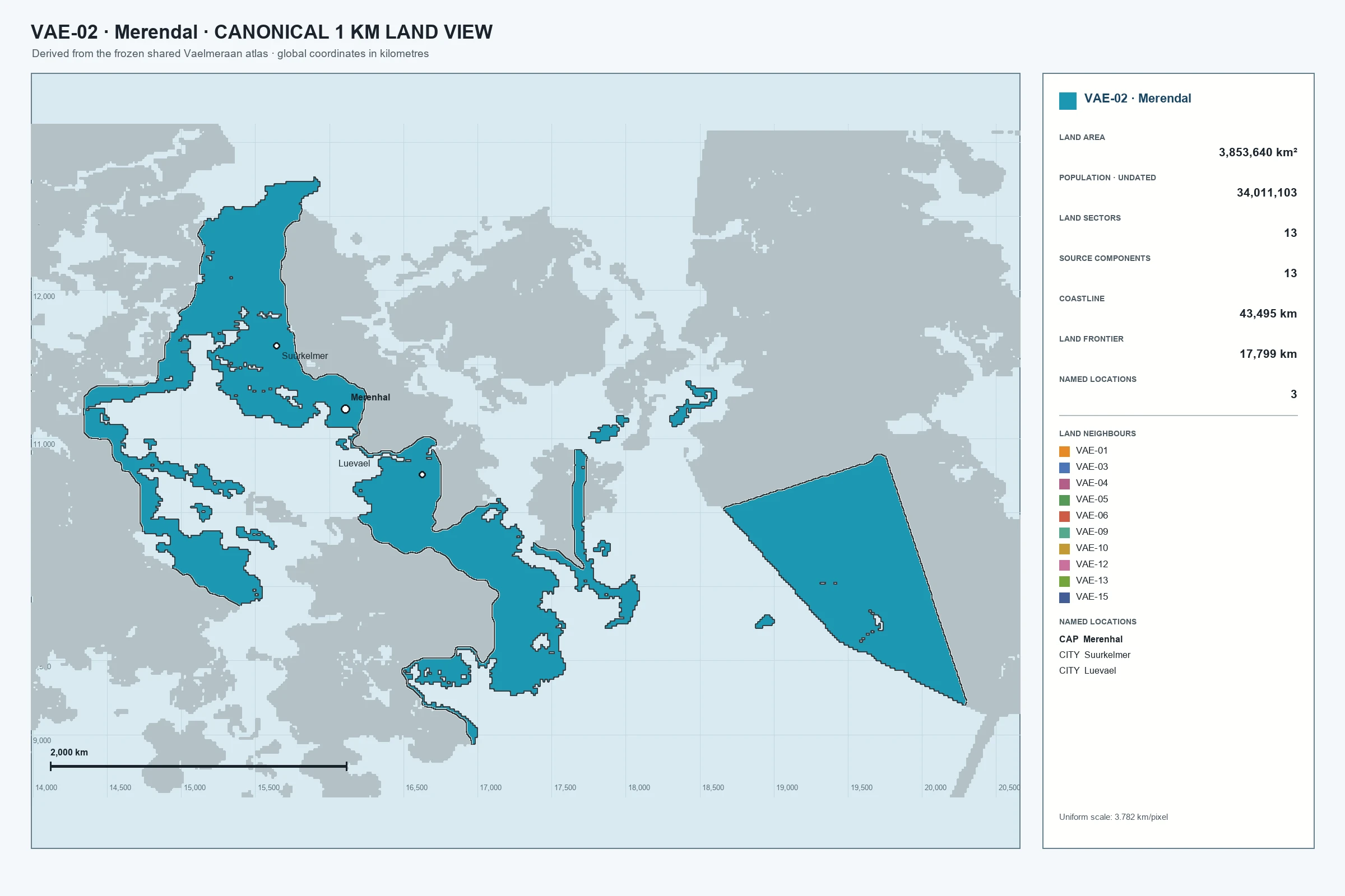
Merendal’s map combines its exact cells with measured land area, coastline, frontier length, sectors, neighbours and named locations. It remains a country view of the continental source, not a disconnected redraw.
Exact elevation
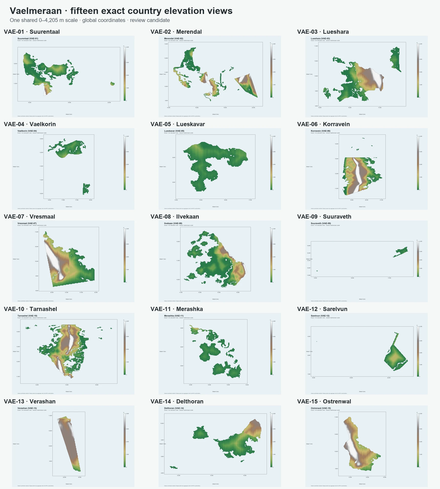
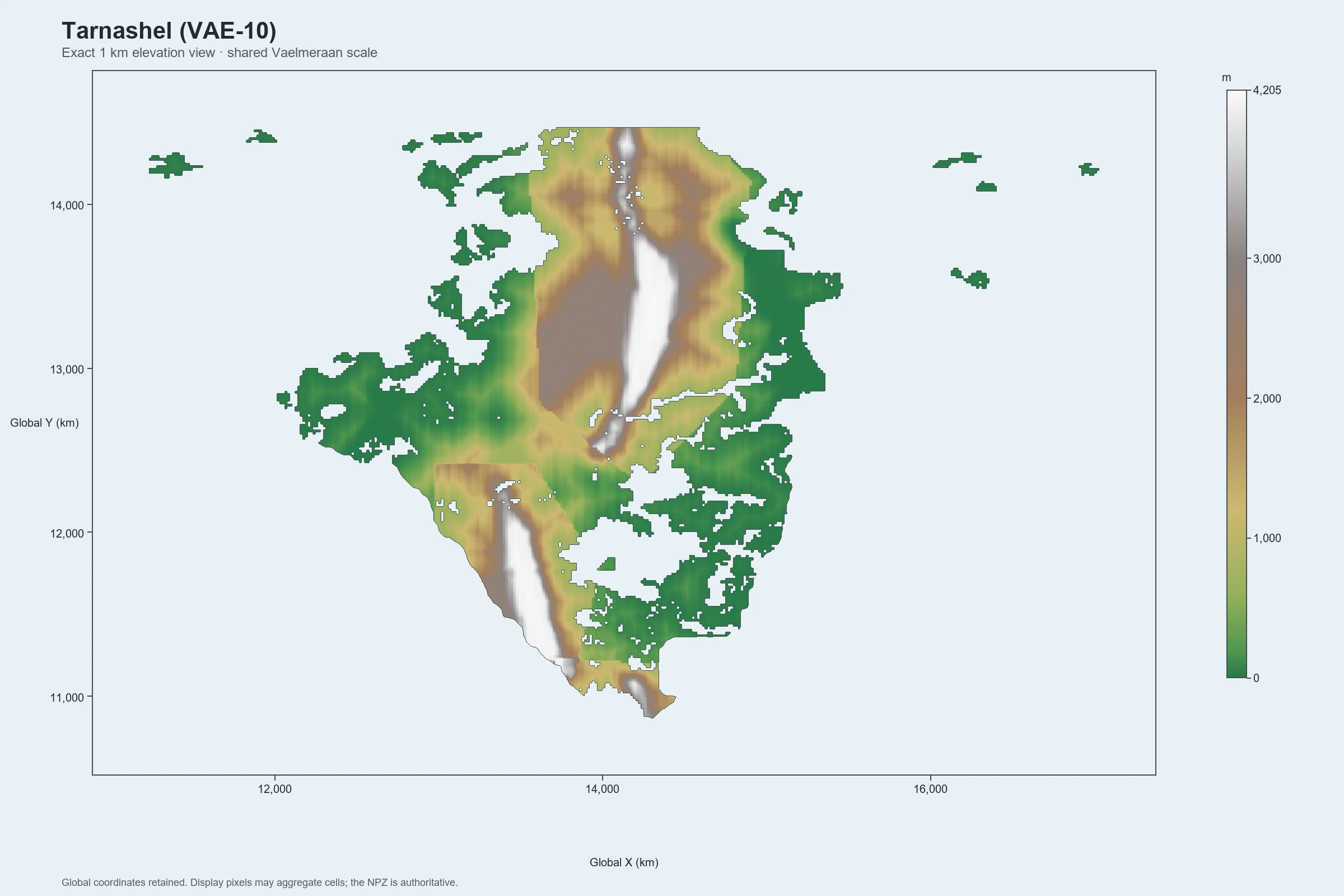
Vaelmeraan’s shared elevation field generates fifteen exact country views on a common 0–4,205 metre scale. All 105 array comparisons are bit-exact and all 31,881 frontier edges are covered without smoothing or rescaling.
Fail-closed governance
The workflow separates construction, checking, human review and authority. It also records exclusions, so accepting land geometry cannot accidentally authorise rivers, climate or transport.
Recover or generate the proposed geometry and its complete machine-readable payload.
Recompute structural, numerical and boundary controls separately from the builder.
Create focused QA plates that make the material decision understandable to a person.
A candidate becomes authority only through a recorded decision with a defined scope.
Hashes preserve the accepted package; later change must identify what it replaces.
The accepted package preserves exact cell ownership, geometry, frontier lengths, coordinate space and hashes—and requires explicit supersession for future change.
Active physical-geography research
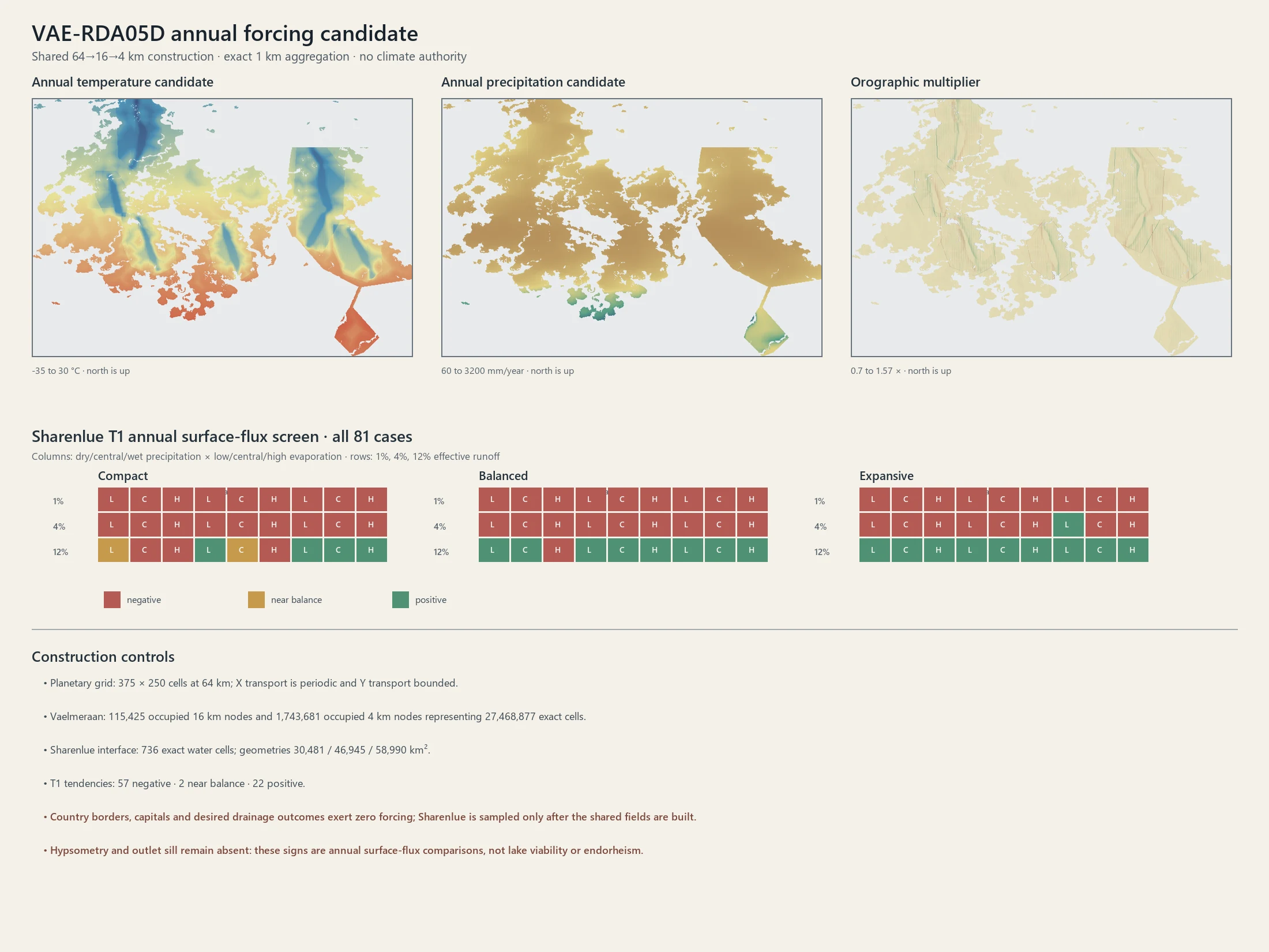
Elevation now feeds controlled climate-forcing, drainage and lake sensitivity work. The Atlas distinguishes diagnostic evidence from accepted physical facts, allowing weak models to fail without contaminating the frozen land authority.
A global naming bank already protects 128 unique proper names across 140 physical roles. Assignment waits until the underlying river, lake or other feature is physically accepted.
Current state
World coordinates, Vaelmeraan land ownership, country views, metadata and exact shared elevation derivatives.
Physical-geography modelling, especially controlled climate, drainage, lake and exact-forcing investigations.
Extend the same topology-first, independently validated treatment to the remaining continents and downstream systems.
Beyond worldbuilding: the same approach applies wherever visual or expert knowledge must become structured, traceable data without losing its original intent.
Start a conversation
Bring the complicated version. We’ll define what needs to work, agree a sensible scope and identify whether the right next step is discovery, prototype, build or deployment.